The Wonderland Trail: A Complete Guide for 2026
Dreaming of circumnavigating Mount Rainier? Our complete Wonderland Trail guide has everything you need to plan, train for, and conquer the iconic 93-mile loop.
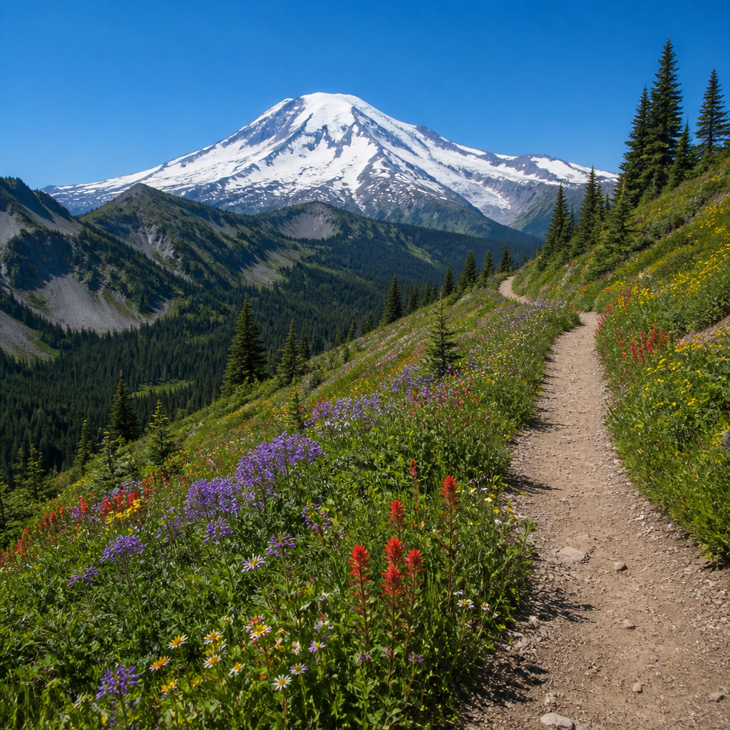
Thinking about the Wonderland Trail? Good. It means you’re the kind of hiker who doesn’t just look at a mountain—you want to know it. You want to walk all the way around it. The 93-mile trail circumnavigating Tahoma (Mount Rainier) isn’t just a walk in a very, very large park. It’s a pilgrimage through ancient forests, across glacial rivers, and up to wildflower-strewn alpine meadows that will fundamentally change how you see the Pacific Northwest.
But this trip of a lifetime doesn’t happen by accident. It requires meticulous planning, serious physical preparation, and a little bit of luck. This guide is your first and most important step. We’ve distilled decades of collective trail wisdom into a comprehensive plan to get you from the lottery application to your final, triumphant steps back at the trailhead.
Trail Snapshot: The Wonderland at a Glance
| Stat | Details | | --- | --- | | Distance | ~93 miles (150 km) loop | | Total Elevation Gain/Loss | ~23,000 feet (7,010 meters) | | Difficulty | Strenuous | | Permit Required? | Yes, via a highly competitive annual lottery or limited walk-up permits. | | Best Season | Late July to mid-September | | Typical Duration | 8-12 days |
Getting There
Your journey to the Wonderland Trail begins long before you set foot on dirt. Most hikers fly into Seattle-Tacoma International Airport (Sea-Tac), which is about a 2-hour drive from the most common starting points within Mount Rainier National Park.
There is no single 'official' trailhead. You can start your loop from several locations, but these are the most popular:
- Longmire (Southwest): A historic district with a museum, a small store, and lodging. It offers a gentle start but means you have a long way to your first food cache.
- Sunrise (Northeast): The highest point in the park reachable by car. Starting here gets some of the high-elevation travel done early, but the visitor center opens late in the season.
- Mowich Lake (Northwest): A more rugged, remote starting point at the end of a rough gravel road. It's a great spot for a pre-placed food cache.
No matter where you start, you'll need a park entrance pass in addition to your wilderness permit. Plan to arrive a day early to acclimate, pick up your permit from the ranger station, and drop any food caches.
Trail Description: A Lap Around the Mountain
The Wonderland is less like one long trail and more like a series of massive, steep climbs from a river valley up to a high pass, followed by an immediate and equally steep descent. We recommend hiking counter-clockwise, as it breaks up the climbs a bit more favorably. Here's what to expect in four major sections, starting from Longmire.
Section 1: Longmire to Mowich Lake (~32 miles)
Leaving the historic lawns of Longmire, you immediately cross the Nisqually River on a sturdy bridge before beginning a long, forested climb. The first few days are a masterclass in what the Wonderland is all about: deep woods, powerful rivers, and relentless elevation change. The highlights here are the stunning floral displays in Indian Henry's Hunting Ground and the airy traverse across the Tahoma Creek Suspension Bridge. As you approach South Puyallup River Camp, you'll get your first dramatic, up-close views of the Tahoma Glacier. The final push to Mowich Lake is a grinder, but your reward is (hopefully) your first food cache and a stunning lakeside campsite.
Section 2: Mowich Lake to White River (~23 miles)
This section contains some of the most sublime and challenging terrain on the entire loop. From Mowich, you can choose between the official trail or the Spray Park alternate—always choose Spray Park if the weather is clear. It's a breathtaking high-alpine route bursting with wildflowers and offering panoramic views that will make you forget the climb. After Spray Park, you descend sharply to the Carbon River, home to the lowest point on the trail and the terminus of the Carbon Glacier, the largest in the lower 48. From here, it's the trail's most notorious single climb: a 3,300-foot ascent from the Carbon River to Moraine Park. The switchbacks are relentless, but the view from the top, looking back at the glacier-carved valley, is an all-timer. You'll finish this leg with a descent to the bustling White River Campground, your second major resupply point.
Section 3: White River to Stevens Canyon (~21 miles)
Get ready to climb again. From White River, you ascend through classic subalpine forest to the Sunrise area. This is the park's highest developed area and can feel like a bit of a shock to the system with its crowds and paved paths. Push through it. The trail beyond Sunrise leads to Panhandle Gap, the highest point on the Wonderland Trail at 6,800 feet. The landscape here is stark, rocky, and often holds snow well into August. The views south towards the Goat Rocks and Mount Adams are spectacular. From the gap, you begin a long, knee-pounding descent into the Ohanapecosh drainage, a world of ancient, moss-draped trees and vibrant green forest floors. You'll camp near the beautiful Ohanapecosh River before one last climb and drop to Stevens Canyon.
Section 4: Stevens Canyon to Longmire (~17 miles)
This is the home stretch. You'll cross Stevens Creek and immediately begin yet another significant climb towards Reflection Lakes. If the wind is calm, you might be lucky enough to catch the iconic mirror-image of Mount Rainier on the water's surface. The trail then contours for several miles, a welcome reprieve from the constant up-and-down. The final descent back to Longmire follows the Paradise River. The sound of the river will be your companion as the forest grows thicker and you finally emerge back into civilization, tired, dusty, and forever changed by your lap around the mountain.
Water, Camping, and The Permit Lottery
Camping: You MUST camp in designated backcountry sites, and your permit will list your specific itinerary. There are 18 trailside camps, each with 1-8 individual sites, a pit or composting toilet, and a bear pole. The system is rigid; you cannot just stop and camp where you want.
The Lottery: Getting a permit is the biggest hurdle. The National Park Service runs an online lottery, typically in February/March. You submit your ideal itinerary, group size, and dates. Success rates are very low, often under 10%. Have backup dates and be flexible with your itinerary (e.g., higher or lower mileage days).
Walk-up Permits: A small number of permits are reserved for first-come, first-served walk-ups. To have a chance, you need to show up at a Wilderness Information Center several days before you want to start, ready with multiple potential itineraries. It's a long shot, but possible.
Water: Water is plentiful on the trail from streams and glacial melt. You are rarely more than a few miles from a source. However, ALL water must be treated. The glacial runoff can be heavy with silt, which can clog filters. A Sawyer Squeeze or Katadyn BeFree are excellent choices, but consider pre-filtering silty water through a bandana.
Food Caches: To avoid carrying 8-12 days of food, you must use food caches. You'll pack your food into sealed, rodent-proof plastic buckets (5-gallon is standard) and drop them off at ranger stations before you start your hike. The two most common locations are:
- White River Campground
- Mowich Lake (Note: You drive your own cache up the gravel road to the ranger station here).
Essential Gear for the Wonderland Trail
This is not the place to skimp. Your gear needs to be reliable, reasonably lightweight, and suited for mountain weather that can change in an instant.
- The Big Three:
- Backpack: A 50-65 liter pack is ideal. Look for comfort under load. The Osprey Atmos AG or Gregory Baltoro are legendary for a reason.
- Tent: A sturdy, lightweight, waterproof shelter is non-negotiable. The Big Agnes Copper Spur HV UL2 is a perennial favorite.
- Sleep System: A 20°F (-6°C) quilt or sleeping bag and an insulated sleeping pad (R-value of 3+) like the Therm-a-Rest NeoAir XLite.
- Footwear: Broken-in trail runners or lightweight hiking boots. Waterproofing is a personal choice, but non-waterproof shoes will dry much faster after river crossings or rain. Pair with Darn Tough wool socks.
- Clothing (No Cotton!):
- Hiking shirt (synthetic or merino wool)
- Hiking shorts or pants
- Rain jacket (essential). The Arc'teryx Beta or Patagonia Torrentshell are solid picks.
- Rain pants (highly recommended)
- Puffy jacket (for cold nights and mornings)
- Base layers for sleeping
- Kitchen & Hydration:
- Canister stove (MSR PocketRocket 2 is a classic), fuel, and pot
- Spork and a small cup
- Water filter (e.g., Sawyer Squeeze) and 2L of water capacity (bottles or bladder)
- Navigation & Safety:
- Map of the trail and a compass (and know how to use them)
- GPS device or phone with downloaded maps (e.g., Gaia GPS)
- Personal Locator Beacon (e.g., Garmin inReach Mini)
- Headlamp with extra batteries
- First-aid kit
Pro Tips for a Successful Hike
- Train for the 'PUDs': Focus your training on 'Pointless Ups and Downs.' Find the biggest hill you can and do repeats with a weighted pack. Leg strength and cardio are your best friends on the Wonderland.
- Go Counter-Clockwise: Most hikers prefer this direction. It front-loads some of the tougher climbs into the middle of your trip when you're fully trail-hardened, and it saves some of the best views for the second half.
- Master the Food Cache: Clearly label your buckets with your name and permit start date. Pack a few treats—you'll have earned them by the time you reach your cache.
- Trekking Poles Are Not Optional: They will save your knees on the 23,000 feet of descent. Don't even think about leaving them at home.
- Embrace the Rain: It's the Pacific Northwest. You will likely get rained on. A good rain jacket and a positive attitude are the best tools for dealing with it.
FAQ
How hard is it to get a Wonderland Trail permit? Extremely hard. The lottery system is highly competitive. In 2024, the park received applications for over 25,000 people for an estimated 800 available slots. Your best bet is to be flexible with your dates and apply the moment the lottery opens.
Can you hike the Wonderland Trail without a permit? No, you cannot complete the entire loop or camp overnight without a valid wilderness permit. However, the trail is open to day hikers, so you can experience beautiful sections like Spray Park or the area around Sunrise on long day hikes without needing an overnight permit.
What is the hardest part of the Wonderland Trail? Most thru-hikers agree it's not one single spot, but the cumulative effect of the relentless elevation changes. The trail constantly drops into a deep river valley and then immediately climbs 2,000-3,500 feet back out. The mental and physical grind of doing this day after day is the true challenge.
How many days does it take to hike the Wonderland Trail? The most common itinerary is 10 days, averaging about 9.3 miles per day. Faster hikers might do it in 7-8 days, while those who want a more relaxed pace or more zero days might take up to 14 days, which is the maximum trip length allowed by the park.
<!-- seo-rank-booster:v1 -->Frequently Asked Questions
How hard is the Wonderland Trail?
The Wonderland Trail is extremely strenuous and considered a significant physical challenge. Over its 93-mile length, hikers gain and lose approximately 23,000 feet of elevation, often in a series of relentless climbs and descents. Successful completion requires a high level of physical fitness, dedicated training, and backpacking experience.
How do you get a permit for the Wonderland Trail?
Permits are mandatory and highly competitive. Most are awarded through an annual online lottery system that typically opens in February for the upcoming summer season. A very small number of first-come, first-served (walk-up) permits are available at ranger stations in the park, but securing one requires significant luck and flexibility.
Which direction should I hike the Wonderland Trail?
While the trail can be hiked in either direction, most thru-hikers choose to travel counter-clockwise. This direction is often preferred because it breaks up some of the most challenging climbs more favorably and can offer better afternoon lighting for views of Mount Rainier's southern and western flanks. However, the best direction ultimately depends on your specific itinerary and campsite availability.
What is the best time to hike the Wonderland Trail?
The prime hiking season is very short, typically lasting from late July to mid-September. This window is when the trail is most likely to be snow-free, the river crossings are more manageable, and the famous alpine wildflowers are at their peak. Be aware that weather can change rapidly at any time of year, and snow can linger at high elevations well into July.
Related on Bucketlist Field Guide
- Skyline Trail Loop — Experience the stunning alpine meadows of Mount Rainier on this classic, must-do day hike.
- Hoh River Trail to Blue Glacier — Hike from a temperate rainforest to a massive glacier on another iconic multi-day trek in Washington.
- Presidential Traverse — Tackle the East Coast's most famous multi-day ridge hike for a different kind of alpine challenge.
- Harding Icefield Trail — Journey to the edge of a massive icefield on this strenuous but rewarding Alaskan trail.