
The Iceline Trail
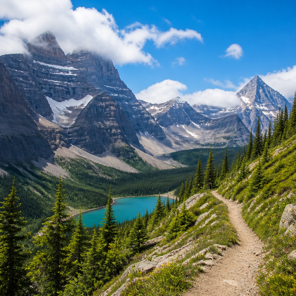
Step into a raw, primeval landscape on the Iceline Trail, a route that trades forested valleys for an open alpine bench high above the Yoho Valley. Here, you'll walk alongside the immense Waputik Icefield and its glacial tongues, witnessing the powerful forces that have sculpted the Canadian Rockies.
- Difficulty
- hard
- Distance
- 13.1 mi
- Elevation gain
- 3475 ft
- Permit
- Not required
Why It's Special
The Iceline Trail is a masterclass in geologic grandeur, offering a journey across a high-alpine landscape shaped by immense frozen rivers. Unlike valley-bottom trails that look up at mountains, the Iceline puts you right on the shoulder of them, granting an intimate perspective of the Waputik Icefield and its massive glacial tongues, including the Daly and Emerald Glaciers. The trail traverses a stark, beautiful bench just below the retreating ice, a world of moraine, meltwater streams, and resilient alpine flora.
From this incredible vantage point, the views are unrelenting. You'll gaze down upon the thundering cascade of Takakkaw Falls—one of Canada's tallest—and across the Yoho Valley to the distant peaks of the President Range. This dramatic contrast between the barren, ice-scoured terrain underfoot and the lush, green valley thousands of feet below is what defines the experience. It's a raw, powerful hike that makes you feel both small and profoundly connected to the immense forces of nature.
Best Season
The prime hiking window for the Iceline Trail is relatively short, running from early July through late September. Trails at this elevation in the Canadian Rockies are often snow-covered well into June. Attempting the hike too early in the season can mean navigating steep, hazardous snow slopes without a clear trail.
The sweet spot is from mid-July to late-August. During this period, the trail is typically clear of snow, the days are long, and the alpine meadows burst into a vibrant, if brief, wildflower display. By September, the crowds thin, the larches in the lower valleys may begin to turn golden, and a crispness enters the air. However, be prepared for colder temperatures and the possibility of early-season snowfall, especially later in the month. Always check trail conditions with Parks Canada before you go, as conditions can change rapidly.
Logistics
The journey begins in British Columbia's Yoho National Park. The most common trailhead is at the end of the Yoho Valley Road, at the Takakkaw Falls parking lot. You will need a valid Parks Canada Discovery Pass to enter the park, which can be purchased online or at park gates.
The trail is most often hiked as a loop, approximately 13.1 miles (21.1 km) in total. You have two choices for direction:
- Counter-Clockwise: This is the most popular and arguably more rewarding direction. It tackles the steep 2,200-foot ascent right away, getting the hardest work done early. The payoff is that your time on the Iceline itself is spent walking towards the glaciers, with staggering, head-on views. The descent is long but more gradual, winding down through the Little Yoho Valley past Laughing Falls.
- Clockwise: This route offers a more gradual ascent through the forest along the Yoho Valley Trail. You'll pass several waterfalls before a steep climb up to the Iceline near the Stanley Mitchell Hut. This saves the epic glacier views for the latter half of the hike, enjoyed as you descend back towards Takakkaw Falls.
The closest town with lodging and services is Field, BC, a quaint village just inside the park. More extensive options are available in Lake Louise, AB (30 minutes east) and Banff, AB (90 minutes east).
Pro Tips
- Start Early: The Takakkaw Falls parking lot is a major tourist draw and fills up quickly, especially in peak season. An early start (before 8 AM) ensures you get a parking spot and gives you ample time to complete the long loop without rushing.
- Be Bear Aware: This is grizzly bear country. Hike in groups, make noise, and carry bear spray in an accessible location (like a hip belt holster). Know how to use it. Store food properly if you are camping.
- Layer Up: Alpine weather is notoriously fickle. You can experience intense sun, chilling wind, rain, and even snow, all in the same day. Dress in non-cotton layers, and always pack a waterproof/windproof shell, gloves, and a warm hat.
- Poles are Your Friends: Trekking poles are highly recommended. They save your knees on the long, steep descent and provide crucial stability on rocky sections and any potential snow or stream crossings.
- Hydrate and Fuel: There are streams along the route, but all water must be treated or filtered before drinking. The trail is exposed and strenuous; bring more water and high-energy snacks than you think you'll need.
- Know Your Limits: This is a challenging day hike with significant elevation gain at altitude. Be honest about your fitness level. If the full loop is too much, a fantastic out-and-back hike to the first major viewpoint on the Iceline shelf is still a world-class experience.
Must-use gear on The Iceline Trail
Field-tested picks matched to this terrain. Links are affiliate — they keep the field guide free at no extra cost to you.

Two-way satellite messaging and an SOS button the size of a key fob. If you hike alone, you want this.

The only sock with a true lifetime guarantee. Merino blend, perfect cushioning, zero blisters across hundreds of miles.
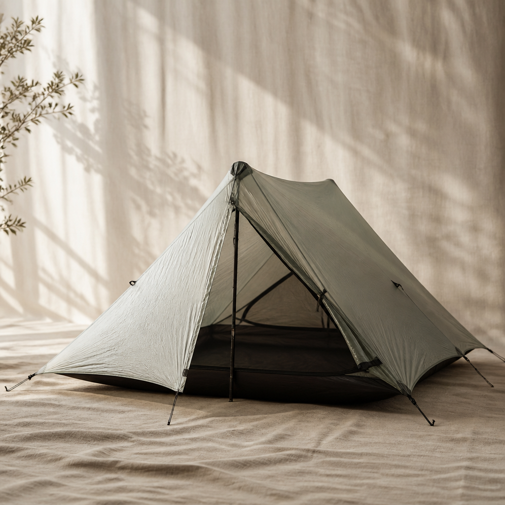
The Durston X-Mid Pro 2 redefines what's possible in an ultralight, two-person trekking pole shelter, offering palatial space and storm-worthy performance at a staggeringly low weight. By utilizing Dyneema Composite Fabric and a brilliant offset pole design, it delivers exceptional livability without the typical compromises of minimalist shelters.
Recommended footwear for this terrain

The best all-around day-hiking boot we tested in 2026. Light, grippy Contagrip outsole, dialed lacing, waterproof without feeling like a sauna.
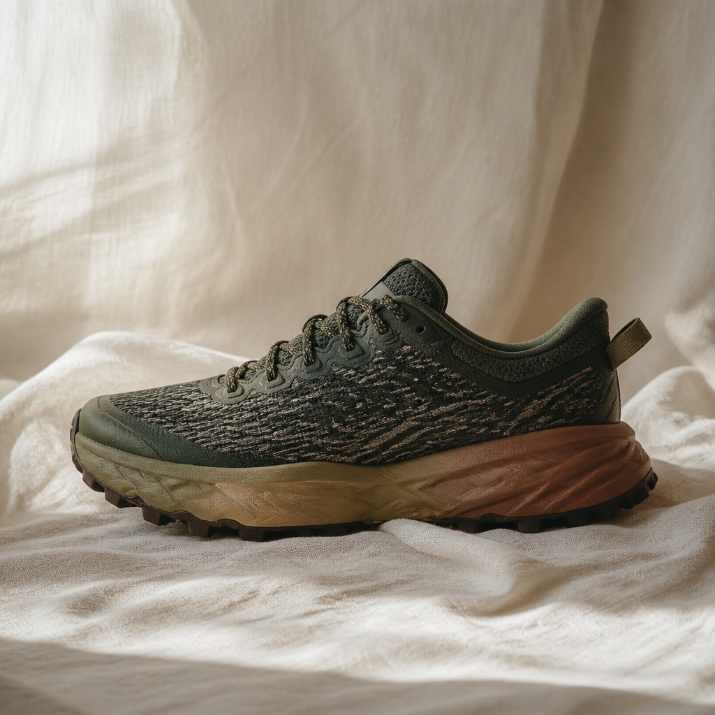
The HOKA Speedgoat 5 continues its reign as a trail-running and hiking favorite, offering unparalleled cushioning for an exceptionally comfortable ride over long distances. Its redesigned Vibram Megagrip outsole with Traction Lugs provides tenacious grip on the most demanding technical terrain, making it a go-to for serious adventurers.
Best hydration for this trail
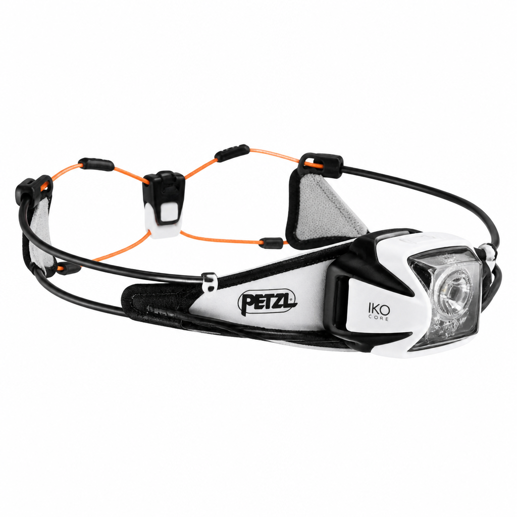
The Petzl Iko Core is a revolutionary rechargeable headlamp that challenges traditional design with its ultra-light, semi-rigid AIRFIT headband. It offers exceptional comfort and balanced weight distribution, making it nearly unnoticeable during high-output activities like trail running and fastpacking.
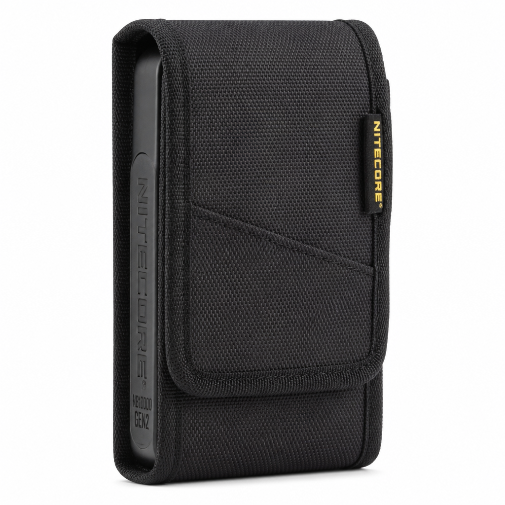
The Nitecore NB10000 Gen 2 is the gold standard for ultralight power banks, packing a massive 10,000mAh capacity into a carbon fiber frame that weighs a mere 5.3 ounces. It's the go-to choice for thru-hikers and weekend warriors who need to keep essential electronics charged without adding punishing weight.