
Presidential Traverse Guide (2026)
Planning to hike the Presidential Traverse? Our complete 2026 guide covers itineraries, gear, and pro tips for conquering this iconic White Mountains ridge.
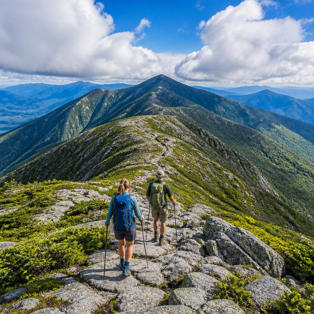
Ever stare at a map of New Hampshire's White Mountains and feel that magnetic pull of the high peaks? For the seasoned hiker who's ready to graduate from day hikes to a true northeastern epic, the Presidential Traverse isn't just another trail—it's a rite of passage. You've heard the whispers: knife-edge ridges, the world's worst weather, and views that stretch to the Atlantic. If you're wondering whether you have what it takes to link these iconic summits, you're in the right place. This is your no-fluff, comprehensive guide to planning and executing a successful Presidential Traverse in 2026.
Trail Snapshot: The Presidential Traverse
| Stat | Detail | | :--- | :--- | | Total Distance | ~23 miles | | Elevation Gain | ~9,000 feet | | Difficulty | Strenuous / Expert | | Permits Required | No trail permit, but reservations for parking, shuttles, and lodging (huts/campsites) are essential and highly competitive. | | Best Season | Late June through September | | Typical Duration| 1-3 days |
Getting There & Logistics
The Presidential Traverse is a point-to-point hike, which means logistics are your first puzzle. You'll be connecting the northern terminus (Appalachia/Valley Way Trailhead on Route 2) and the southern terminus (Highland Center/Crawford Path Trailhead on Route 302).
Trailheads
- Northern Terminus (Appalachia): Located on Route 2, east of Randolph, NH. This large lot still fills up extremely early, especially on weekends. A parking reservation via the AMC's system might be an option; check their site for the latest 2026 policies.
- Southern Terminus (Crawford Notch): The route typically ends at the AMC Highland Center on Route 302. Parking here is also tight.
The Shuttle Solution
The easiest way to solve the car problem is with a shuttle. Several private shuttle services operate in the area. The standard practice is to park your car at the terminus where you plan to finish (Crawford Notch for a Northbound hike) and take an early morning shuttle to your starting point (Appalachia). This way, your car is waiting for you the moment you stumble off the trail.
Trail Description: A Northbound Itinerary
Most hikers tackle the Traverse from North to South (NoBo), getting the steepest, most rugged climbs out of the way on fresh legs. This guide assumes a NoBo route, typically broken into two or three days.
Day 1: The Ascent to the Gods (Appalachia to Madison Spring Hut)
- Distance: ~4.5 miles
- Elevation Gain: ~4,000 feet
Don't let the short mileage fool you; this is a grueling start. From the Appalachia trailhead, you'll take the Valley Way trail. It's a relentless, rocky climb through the forest. The footing is tricky, and it feels much longer than it is. After what feels like an eternity, you'll break treeline. The reward is your first view of the hut, nestled between the bouldery cones of Mount Madison and Mount Adams. Drop your pack at the hut and, if you have the energy, make the short but steep scramble up the 0.5-mile spur trail to the summit of Mount Madison (5,367').
Day 2: The High Ridge (Madison Hut to Lakes of the Clouds Hut)
- Distance: ~7.5 miles
- Summits: Adams, Jefferson, Washington
This is the heart of the Traverse. You will be almost entirely above treeline, exposed to whatever weather the mountains throw at you. From Madison Hut, you'll follow the Gulfside Trail, a masterwork of rock cairns. You'll tackle a series of major summits via short but demanding spur trails:
- Mount Adams (5,774'): A massive, complicated pile of rock. The summit scramble is no joke.
- Mount Jefferson (5,712'): Reaching Jefferson involves navigating Jefferson's Knee and crossing more spectacular, boulder-strewn terrain.
- Mount Washington (6,288'): The big one. The final ascent up Washington's cone is a formidable rock-hop. You'll arrive at the summit complex, a surreal world of a parking lot, visitor center, and the Mount Washington Observatory. Brace for tourist crowds and potentially severe weather. Grab a snack, refill water, and begin the 1.5-mile trek down to Lakes of the Clouds Hut, your refuge for the night, sitting dramatically in the col between Washington and Monroe.
Day 3: The Southern Presidentials & Descent (Lakes Hut to Crawford Notch)
- Distance: ~8 miles
- Summits: Monroe, Eisenhower, Pierce
The terrain on the southern half of the ridge is generally gentler, with more forgiving footing and broad, grassy shoulders between peaks.
- Mount Monroe (5,384'): An easy and rewarding scramble from the hut with fantastic views back toward Washington.
- Mount Eisenhower (4,780'): Known for its iconic, circular summit cairn and expansive 360-degree views.
- Mount Pierce (4,310'): Your final official presidential peak, marking the beginning of your descent back into the treeline.
From Pierce, you'll follow the Crawford Path—the oldest continuously used hiking trail in the United States—on a long but moderate descent to the AMC Highland Center at Crawford Notch.
Water & Camping Strategy
Your overnight strategy dictates your entire trip. You cannot stealth camp in the alpine zone.
- AMC Huts: The gold standard. Madison Spring Hut, Lakes of the Clouds Hut, and Mizpah Spring Hut are perfectly spaced for a 2-night itinerary. They provide a bunk, dinner, and breakfast. Water is available. They are expensive and require booking months in advance—reservations for the 2026 season will likely open in late 2025. Set a calendar reminder.
- Designated Campsites: For a more rustic experience, you can stay at designated backcountry sites. Valley Way Tentsite (near Madison Hut) and Nauman Tentsite (at Mizpah Hut) have platforms and require a fee. The RMC's Perch Path Tentsite is another option in the northern section. This requires you to carry a full backpacking setup.
- Water: Reliable water sources are primarily at the huts and designated campsites. Treat all natural water sources. On the exposed ridge between huts, water is scarce, so carry at least 2-3 liters.
Essential Gear Checklist
This is not the place to skimp. The weather can turn from sunny to life-threatening in minutes.
- The '10 Essentials': Navigation (map/compass AND GPS), headlamp, sun protection, first aid, knife, fire starter, shelter (even a bivy for emergencies), extra food, extra water, extra clothes.
- Rain Gear (Non-Negotiable): A high-quality waterproof/breathable jacket (like an Arc'teryx Beta) and full-zip rain pants. Not 'water-resistant'—waterproof.
- Insulation: A puffy jacket (down or synthetic) and a fleece layer. Bring a warm hat and gloves, even in August.
- Footwear: Sturdy, broken-in hiking boots with excellent ankle support. The rocks are brutal. Pair with Darn Tough wool socks.
- Trekking Poles: Absolutely essential for saving your knees on the descents and for stability on the endless rocks. Black Diamond Trail Erks are a solid choice.
- Backpack: A 35-50L pack is ideal. An Osprey Talon 44 or Gregory Zulu 45 offers a great balance of size and comfort.
- Water Filter: A Sawyer Squeeze or Katadyn BeFree is lightweight and effective.
Pro Tips for the Traverse
- Worship the Forecast: The only forecast that matters is the Mount Washington Observatory's Higher Summits Forecast. Check it right before you leave. If it predicts sustained winds over 50 mph or thunderstorms, postpone your trip.
- Know Your Bailouts: Study the map for escape routes. Key bailouts include the Jewell Trail or Ammonoosuc Ravine Trail off the Gulfside Trail, and the Crawford Path for the southern peaks.
- Start at Dawn: An early start gives you more daylight to work with and a better chance of beating afternoon thunderstorms.
- The Single-Day Traverse: Often called the 'Presi Death March', this is an option for elite trail runners and endurance athletes only. For 99% of hikers, a 2 or 3-day trip is far safer and more enjoyable.
- Embrace the Hut Culture: If you stay at the huts, chat with the 'croo.' They are a wealth of knowledge on trail conditions and weather.
FAQ
Can you do the Presidential Traverse in one day? Yes, but it's an extreme endurance challenge covering ~23 miles and 9,000 feet of gain over technical terrain. It should only be attempted by very experienced, fit trail runners who have a perfect weather window. For most hikers, a 2 or 3-day trip is the recommended approach.
How hard is the Presidential Traverse, really? It is one of the most difficult multi-day hikes in the Eastern United States. The difficulty comes not just from the distance and elevation, but from the relentlessly rocky and technical terrain and the extreme, unpredictable weather. Do not underestimate it.
What's the best direction to hike the traverse, Northbound or Southbound? Most hikers go Northbound (Appalachia to Crawford Notch). This tackles the steepest and most rugged terrain (Madison and Adams) on the first day with fresh legs. Southbound offers a more gradual ascent up Mt. Pierce but leaves the most difficult sections for the end when you are most fatigued.
Do I need a permit for the Presidential Traverse? No, there is no permit required to hike the trail itself. However, you absolutely need advance reservations for parking at some trailheads and for any overnight lodging, whether it's at an AMC hut or a designated backcountry campsite. These reservations are essential and fill up months in advance.
What are the most important pieces of gear for the Presidentials? Beyond the 10 essentials, the three most critical items are: 1) High-quality, fully waterproof rain jacket and pants, 2) Insulating layers (puffy, fleece, hat, gloves) regardless of the summer forecast, and 3) Sturdy, supportive hiking boots to handle the rocky terrain.