Lost Coast Trail: A Complete Guide for 2026
Planning to hike California's legendary Lost Coast Trail in 2026? Our guide covers permits, tides, shuttles, and mile-by-mile beta for this epic trek.
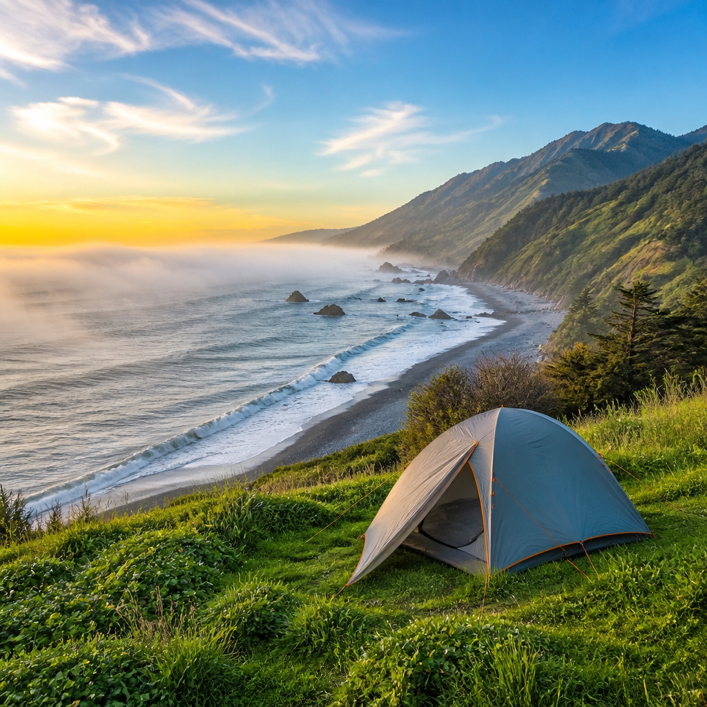
Tired of crowded Sierra granite? Dreaming of a trail where the rhythm of the ocean, not the chatter of other hikers, sets the pace? Welcome to the Lost Coast, California's last wild shoreline, a place so rugged that highway engineers gave up and routed Highway 1 inland. Hiking here isn't just a walk on the beach; it's a raw, elemental experience of fog, wind, and tides.
For 25 spectacular miles, this trail trades switchbacks for sand slogging and mountain passes for impassable headlands that vanish under the surf. It demands respect, careful planning, and a certain comfort with being small against the vastness of the Pacific. But the reward is profound: solitude, stunning beauty, and the satisfaction of traversing one of the most unique coastal trails on the planet. This is your complete guide to doing it right in 2026.
Trail Snapshot: The Lost Coast (North Section)
| Statistic | Details | |-------------------|-----------------------------------------------------------------------------------------------------| | Distance | ~25.1 miles (40.4 km) | | Elevation | ~1,500 ft gain/loss (deceptively flat; the challenge is the terrain, not the incline) | | Difficulty | Strenuous | | Permit | Yes, required year-round. Booked on Recreation.gov. Extremely competitive. | | Best Season | Spring (late April-June) and Fall (September-October) for clearer skies and milder weather. | | Bear Canisters| Required by the Bureau of Land Management (BLM). Non-negotiable. | | Route | Point-to-point, typically hiked North to South (Mattole Beach to Black Sands Beach). |
Getting There & Shuttle Logistics
The Lost Coast is remote. The northern trailhead (Mattole) and southern trailhead (Black Sands Beach) are a stunning, but slow, 2.5-hour drive apart on winding mountain roads. You cannot simply finish and walk back to your car. Logistics are everything.
Most hikers fly into Arcata-Eureka (ACV), San Francisco (SFO), or Sacramento (SMF) and rent a car. The southern trailhead is at Black Sands Beach, just outside the tiny town of Shelter Cove. This is where you should park your car.
The Golden Rule of the Lost Coast: Drive to your endpoint (Black Sands Beach), park your car, and take a pre-booked shuttle to the start (Mattole). This way, you hike back to your vehicle at your own pace and aren't rushing to meet a shuttle on your last day.
Several shuttle operators service the route. Lost Coast Adventure Tours is a popular and reliable choice. Book your shuttle reservation the moment you secure your permit. They book up just as fast.
Trail Description: North to South
Hiking north to south is strongly recommended. You'll have the prevailing northwesterly wind at your back, pushing you down the coast instead of fighting you every step of the way.
Section 1: Mattole Trailhead to Sea Lion Gulch (Miles 0 – 5.5)
After your shuttle drops you at the Mattole Beach campground, you'll sign the trail register and begin. The first few miles are a mix of sand and shelf-walking. About a mile in, you’ll encounter your first challenge: wading through Punta Gorda Creek. Early in the season, it can be swift and cold.
At mile 3, you'll reach the iconic Punta Gorda Lighthouse, a picturesque relic from 1912. It’s a great spot for a snack. The trail continues over rocky terrain, and you’ll soon hear (and smell) the boisterous colony of sea lions that gives Sea Lion Gulch its name. This area has some excellent campsites perched on the bluff just before the gulch, offering great views and protection from high tides.
Section 2: Sea Lion Gulch to Big Flat (Miles 5.5 – 17.5)
This is the heart of the Lost Coast and where your tide chart becomes your bible. This section contains two long stretches of coastline that are completely impassable during high tide. Check your tide chart: you need a tide of 3 feet or lower for safe passage.
- Impassable Zone 1 (Miles 5.5 - 9.5): Begins just after Sea Lion Gulch. This 4-mile stretch requires careful timing. It's a surreal landscape of boulders, tide pools, and narrow beaches. If you time it right, it's a joy. If you don't, you'll be scrambling on slippery rocks or forced to wait for hours.
- Impassable Zone 2 (Miles 15.5 - 17): A shorter but equally critical zone just before Miller Flat.
Between these zones, you'll cross several creeks (Cooskie Creek is a popular lunch spot and campsite) and navigate a mix of sand and rock. The payoff for your planning is Big Flat at mile 17.5. As its name suggests, it’s a massive expanse of grass and driftwood with a beautiful creek and some of the best campsites on the trail. It's a backpacker's paradise.
Section 3: Big Flat to Black Sands Beach (Miles 17.5 – 25.1)
Get ready for the finale: The Slog. The last 7.6 miles are almost entirely on soft, black sand or rounded, ankle-twisting pebbles. It’s a huge mental and physical challenge. There are no impassable zones here, but the walking is slow and arduous. Throw on a podcast, focus on the rhythm of the waves, and keep putting one foot in front of the other.
Seeing the parking lot at Black Sands Beach is a moment of pure relief and accomplishment. You’ve done it. Now go find your car.
Water, Camping, and Wildlife
Water: Plentiful freshwater streams flow to the ocean every few miles. Key sources include Sea Lion Gulch, Cooskie Creek, Randall Creek, and Big Flat Creek. All water must be treated. A Sawyer Squeeze or Katadyn BeFree filter works perfectly. In late, dry seasons (Oct/Nov), some smaller creeks may be reduced to a trickle.
Camping: Dispersed camping is allowed, but always pitch your tent on durable surfaces well above the high tide line. Look for established sites nestled in the grassy bluffs. Never camp on the open beach. The designated BLM campgrounds are at Mattole and Black Sands Beach.
Wildlife & Food Storage: The Lost Coast is home to black bears. The BLM requires that all food, toiletries, and scented items be stored in an approved bear canister. No exceptions. We recommend a BearVault BV500 for its capacity and clear sides. You'll also see seals, sea lions, deer, and possibly rattlesnakes in the grassy bluffs. Always give wildlife plenty of space.
Essential Lost Coast Gear Checklist
Packing for the Lost Coast means preparing for sun, wind, rain, and sand—all in the same day.
- Navigation & Safety: A physical tide chart for your specific dates is the most important piece of gear. Also carry a GPS map of the trail (e.g., Gaia GPS on your phone) and a satellite messenger like a Garmin inReach Mini 2 or Zoleo for emergencies. There is zero cell service.
- Footwear: Leave the waterproof boots at home. You'll be crossing creeks, and they'll just fill with water. Lightweight, quick-draining trail runners (like the Altra Lone Peak) are ideal. Pair them with sand gaiters—they are a game-changer for keeping the notorious black sand out of your shoes.
- Shelter: A sturdy, aerodynamic tent that can handle high winds is crucial. The MSR Hubba Hubba or Big Agnes Copper Spur are excellent choices. Be prepared to anchor your tent with rocks in addition to stakes.
- Kitchen: A reliable stove like the MSR PocketRocket 2 and an approved bear canister like the BearVault BV450 or BV500.
- Clothing: A bomber rain jacket and rain pants (Arc'teryx Beta or Patagonia Torrentshell). Bring layers: a fleece, a puffy jacket, and sun protection (sun hoodie, hat, sunglasses). The coastal wind can be chilling even on sunny days.
- Trekking Poles: Indispensable for stability on slippery rocks and for trudging through sand.
Pro Tips for the Trail
- Know Your Tides: Before you go, learn to read a tide table. Identify the two low tides and two high tides each day. Plan your hiking in the impassable zones for a falling tide, aiming to be through the section before it hits its lowest point.
- Check the Swell: A tide chart only tells part of the story. Check the marine forecast for ocean swell. A high swell can make even a low tide dangerous. If in doubt, wait it out.
- Poison Oak is Everywhere: The bluffs and areas around creeks are covered in poison oak. Learn to identify it (leaves of three, let it be) and wear long pants if you're sensitive.
- Tick Check: The coastal grasses are prime tick habitat. Do a thorough tick check every single night.
- Embrace the Sand: Fighting the sand is futile. Slow your pace, use your trekking poles, and accept that the final miles will be a grind. It's part of the authentic Lost Coast experience.
FAQ: Lost Coast Trail
How hard is the Lost Coast Trail? It's physically demanding, but not because of elevation. The difficulty comes from walking on varied, unstable surfaces like soft sand, grapefruit-sized rocks, and slippery boulders for 25 miles. It's a full-body workout. We rate it as strenuous.
Do I really need a bear canister? Yes, absolutely. It is not a recommendation; it is a requirement by the BLM. Rangers patrol the area and will issue fines. It protects you, the next hiker, and the bears.
What happens if I get trapped by the tide? Find a safe spot on the bluffs or high on the beach, well above the water line, and wait. The tide cycles are roughly 6 hours, so you may have to wait 8-10 hours for the water to recede enough for safe passage. This is why planning is not optional.
Can you day hike parts of the Lost Coast? Yes. You can hike south from the Mattole trailhead to the Punta Gorda lighthouse and back (about 6 miles round trip). From the south, you can hike north from Black Sands Beach for several miles, but you'll hit deep sand very quickly.
Is the Lost Coast Trail worth it? Without a doubt. For those prepared for its unique challenges, the Lost Coast offers a level of solitude and wild, untamed beauty that is increasingly rare to find. It's a true bucket-list adventure.