
Grand Canyon Rim-to-Rim: A Complete Guide for 2026
Planning the epic Grand Canyon Rim-to-Rim hike in 2026? Our complete guide covers permits, routes, training, and the gear you need to cross this natural wonder safely.
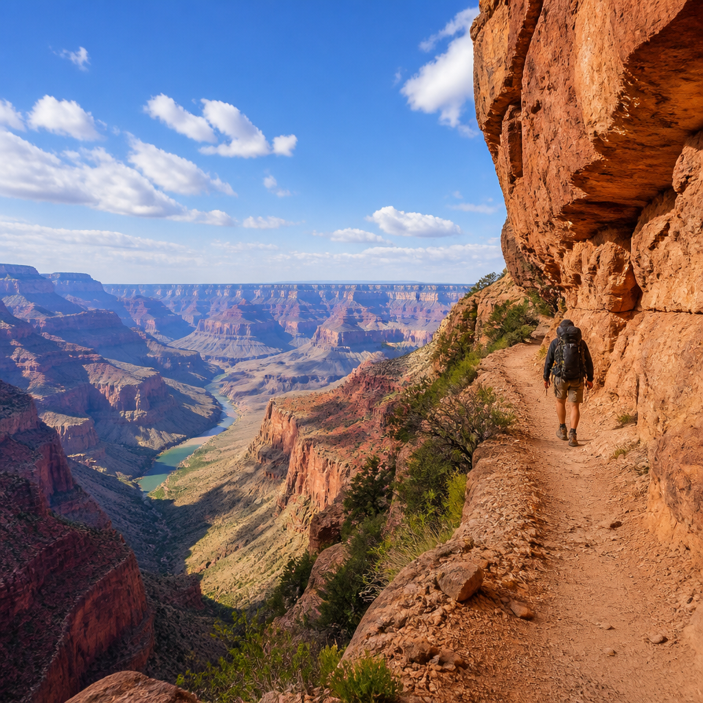
So, you want to walk across the Grand Canyon. It’s a goal that lives on a thousand bucket lists, a primal challenge that whispers to the soul of every serious hiker. But crossing the Grand Canyon Rim-to-Rim (R2R) is not a casual stroll; it’s a monumental undertaking that punishes the unprepared and rewards the diligent with soul-stirring views and an unparalleled sense of accomplishment.
This isn't just a hike; it's a descent into geologic time and a climb back out. It requires meticulous planning, serious physical conditioning, and a deep respect for the desert. You've come to the right place. This guide is your blueprint for a successful and life-changing R2R journey in 2026.
Trail Snapshot: The Classic R2R
This guide focuses on the most popular route: starting at the North Rim (North Kaibab Trail) and finishing at the South Rim (Bright Angel Trail). It's a classic for a reason.
| Statistic | Details | | :--- | :--- | | Total Distance | ~24 miles (38.6 km) | | Elevation Change | ~5,761 ft (1,756 m) descent, ~4,380 ft (1,335 m) ascent | | Difficulty | Extremely Strenuous | | Permit Required? | Yes, a backcountry permit is required for all overnight trips. | | Best Season | Mid-May to mid-June & September to mid-October |
Getting There: The Logistics Puzzle
The R2R is a point-to-point hike, which means logistics are your first hurdle. The North and South Rims are only 24 trail miles apart, but they’re a 215-mile, 4.5-hour drive from each other.
- Airports: The closest major airports are Las Vegas (LAS) and Phoenix (PHX). Flagstaff (FLG) is a smaller, closer option but often more expensive.
- Getting to the Trailhead: Most hikers rent a car and drive to the South Rim, which is open year-round. From there, you have two primary options:
- Park & Shuttle: Park your car at the South Rim (Backcountry Information Center or Bright Angel Lodge). Take the Trans-Canyon Shuttle to the North Rim Lodge. This is the recommended method. You hike towards your car, eliminating deadline pressure.
- Hike & Shuttle: Hike from North to South, then take the shuttle back to the North Rim to retrieve your car. This is less ideal as you're on a tight schedule to catch the shuttle after an exhausting hike.
Book the shuttle months in advance. It sells out, especially during peak season.
Trail Description: North to South
The North Rim sits about 1,000 feet higher than the South Rim, so a North-to-South (N2S) trek means less overall climbing. It also places the most grueling ascent at the end of your trip when your pack is lightest.
The Descent: North Kaibab Trail (14 miles)
You'll start your hike in the cool ponderosa pine forest of the North Rim, an ecosystem that feels worlds away from the canyon floor. Begin well before sunrise.
- Supai Tunnel (Mile 2): The first major landmark. The trail is well-graded but relentlessly downhill. This is where you'll get your first staggering views into the Roaring Springs Canyon.
- Roaring Springs (Mile 4.7): A literal oasis where water gushes from the cliffside. There are restrooms and seasonal water here. It's a great spot for a first major break.
- The Box (Miles 7-12): After passing the Cottonwood Campground turnoff, the trail enters a narrow, high-walled section of the canyon known as "The Box." It parallels Bright Angel Creek and can get incredibly hot as the rock walls radiate the sun's heat. This section feels long. Stay hydrated and manage your effort.
The Canyon Floor: Phantom Ranch (Mile 14)
After emerging from The Box, you'll reach the historic Phantom Ranch, an oasis of cottonwood trees at the bottom of the Grand Canyon. This is a major milestone. You can refill water, buy lemonade, and mail a postcard carried out by mule. Crossing the silver bridge over the powerful Colorado River is a moment you won't forget.
Your overnight destination is likely the Bright Angel Campground, located just past Phantom Ranch. Set up camp, soak your feet in the creek, and get to bed early. The climb starts tomorrow.
The Ascent: Bright Angel Trail (9.9 miles)
This is it. The reason you trained. Another pre-dawn start is non-negotiable.
- River Resthouse (Mile 1.5 from river): The first few miles are a gentle, sandy climb away from the river, lulling you into a false sense of security. Don't be fooled.
- Havasupai Gardens (Mile 4.8 from river): Formerly Indian Garden, this is the last major oasis. It's a beautiful, shady spot with perennial water and a ranger station. Refill every bottle and bladder here. This is your last reliable water source before the rim.
- The Final 4.5 Miles: From the Gardens, the real work begins. The trail steepens considerably. You'll pass the Three-Mile and Mile-and-a-Half Resthouses. These are mental checkpoints. The final set of switchbacks, blasted into the Coconino Sandstone, are famously brutal. Your legs will burn, your lungs will ache, and the rim will seem to never get closer. This is where mental toughness takes over. Go slow, take breaks, and eat snacks. When you finally haul yourself over that last step onto the rim, the feeling is pure elation.
Water & Camping
Water: The Canyon's water system is a lifeline. The Trans-Canyon Pipeline is often under repair, so you must check the Backcountry Updates page on the NPS website for current water status before you start.
- Reliable Sources: North Rim Trailhead, Roaring Springs, Phantom Ranch, Havasupai Gardens, South Rim Trailhead.
- Seasonal Sources: Cottonwood Campground, Three-Mile Resthouse, Mile-and-a-Half Resthouse.
- Always treat water from creek sources. We recommend a lightweight filter like the Katadyn BeFree or Sawyer Squeeze.
Camping: A backcountry permit from the National Park Service is required for any overnight camping below the rim. This is the single hardest part of planning an R2R trip.
- Permit Lottery: Applications are managed through a lottery on Recreation.gov four months before the desired start month. For a popular May trip, you apply in January.
- Campgrounds: You'll be requesting space at Bright Angel Campground (at the bottom) and Havasupai Gardens Campground (midway up Bright Angel). Cottonwood Campground (on North Kaibab) is an option for a more relaxed itinerary.
- Phantom Ranch: For a bed and a hot meal, you can enter a separate lottery for a spot in the dorms or cabins at Phantom Ranch. This is also highly competitive.
Gear Checklist for a 2-Day Trip
Packing for R2R is a balancing act. You need to be prepared for 40-degree temperature swings, but every ounce counts on the climb out. Think "fast and light."
- Backpack: A 20-30L pack is perfect. The Osprey Talon 22 (men's) or Tempest 20 (women's) are classics for a reason.
- Footwear: Do NOT break in new boots. Wear proven trail runners or lightweight hiking shoes. The cushion of a Hoka Speedgoat 5 or the wide toe box of an Altra Lone Peak 8 are popular choices.
- Hydration System: Carry capacity for 3-4 liters. A combination of a 2-3L reservoir and a 1L bottle for electrolytes works well.
- Electrolytes: Crucial for preventing cramps and hyponatremia. Pack tablets or powders like those from Nuun or Liquid I.V.
- Layers: A sun hoodie is your best friend. Add a lightweight fleece and a rain/wind shell.
- Sun Protection: Wide-brimmed hat, sunglasses, and high-SPF sunscreen are non-negotiable.
- Headlamp: You'll be starting in the dark. A reliable headlamp like the Black Diamond Spot 400 is essential.
- Trekking Poles: They will save your knees on the descent and power your legs on the ascent. Lightweight, collapsible poles like the Black Diamond Distance Carbon Z are ideal.
- Nutrition: High-calorie, easy-to-digest snacks. Energy gels, bars, jerky, and salty snacks like pretzels or chips are all great.
- First Aid Kit: A small, personalized kit with extra blister care (leukotape is a game-changer) and pain relievers.
Pro Tips for a Successful Crossing
- Start Before Dawn: Aim to be on the trail by 4 or 5 AM both days. The goal is to avoid hiking in the direct sun during the hottest part of the day (10 AM - 4 PM).
- Train for the Descent: Everyone trains for the climb up, but the 14-mile, 5,700-foot descent is what destroys quads. Find long downhills or even stadium stairs to condition your legs for the eccentric muscle contractions.
- Eat and Drink Before You're Hungry or Thirsty: In the dry desert air, you dehydrate faster than you realize. Sip water constantly and eat a snack every 60-90 minutes.
- Soak in the Creeks: When you get to the bottom, take your shoes off and soak your feet and legs in the cold Bright Angel Creek. It reduces swelling and feels incredible.
- Know the Signs of Heat Stroke and Hyponatremia: Heat exhaustion symptoms include nausea, dizziness, and headache. Hyponatremia (low sodium from over-hydrating without electrolytes) can present similarly. If you feel unwell, stop in the shade, eat something salty, and assess.
FAQ
Which direction is better, North to South or South to North? For most first-timers, North to South is recommended. It involves about 1,400 feet less of total elevation gain, and the descent is more gradual. However, the South Rim is more accessible, so a South-to-North hike can be logistically simpler for some.
Can you do the Rim-to-Rim hike in one day? Yes, but it should only be attempted by highly-trained, acclimated ultra-runners. For the vast majority of hikers, a 2-day or 3-day backpacking trip is a safer, more enjoyable, and more realistic goal. Rushing the canyon means missing its beauty.
What is the hardest part of the Rim-to-Rim hike? Almost universally, hikers agree the final 3-4 miles of the Bright Angel Trail are the most difficult. It's a steep, exposed, and relentless climb at the very end of a massive physical effort, when you are most fatigued.
How do I get a Rim-to-Rim permit for 2026? Backcountry permits are required for all overnight camping. You must enter the permit lottery on Recreation.gov four months and one day prior to your desired start month. For example, for a September 2026 trip, the lottery is open from May 1 to May 20, 2026. Be flexible with your dates to increase your chances.
The Grand Canyon demands respect, but it rewards those who prepare with an experience that echoes for a lifetime. It will test your limits and show you what you're made of. Now, get planning. That pre-dawn start awaits.